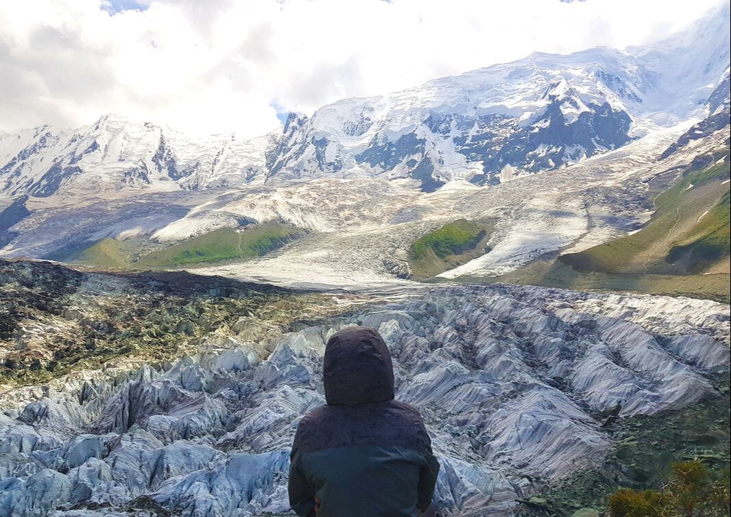
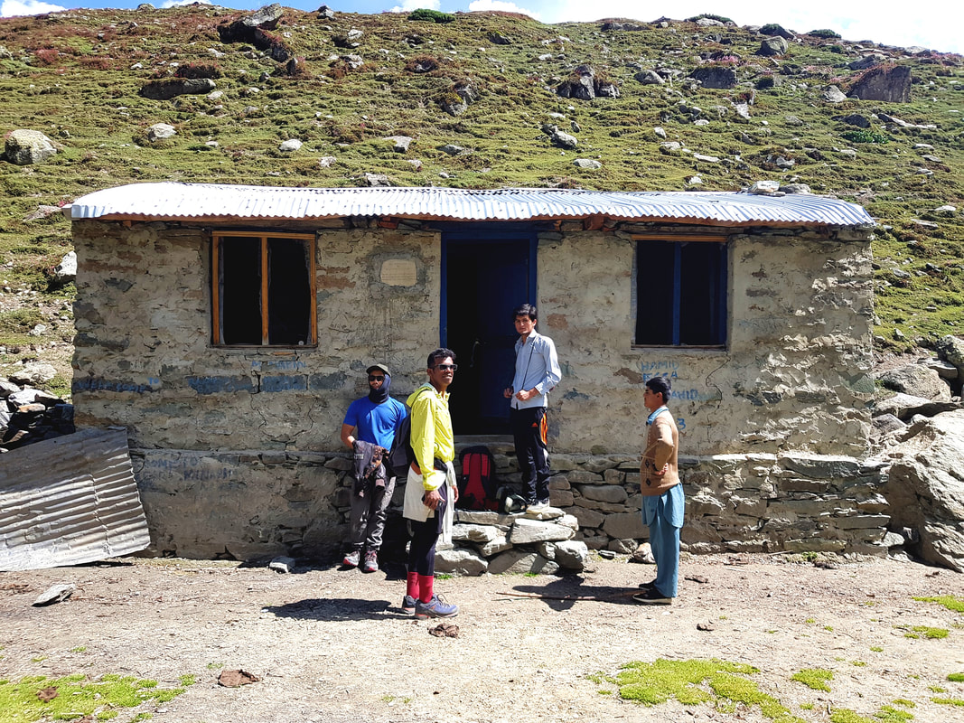
 Sometimes when I think about this particular hike, I think that I might be dreaming. Was I really there? Did I really do it? Unlike the Annapurna Base Camp hike that I did last year, I hardly trained or planned for this one. First of all, I’ve never even heard of Rakaposhi Base Camp until right before I went to Pakistan (I mean, have you?). Secondly, because it isn’t popular, there weren’t many reviews of the hike, so it was easy to underestimate it. And underestimate it I did. In the end, I felt that it was tougher than Annapurna Base Camp, in terms of intensity. 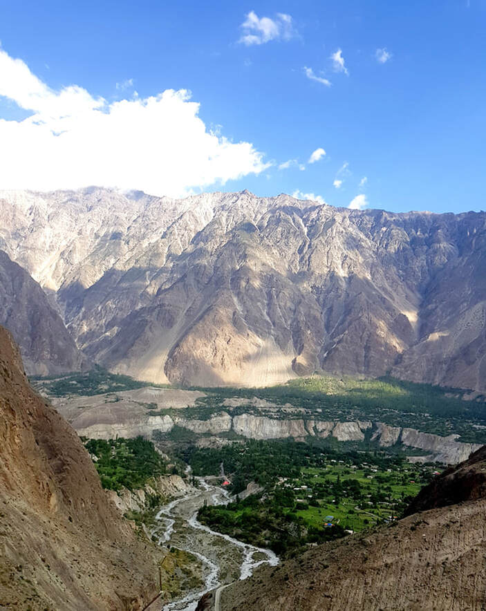 Rakaposhi Mountain is the 27th highest mountain in the world, mostly known for its exceptional rise from an otherwise normal local terrain (translation: steep). It rises 5900 meters in only an 11.2 km horizontal distance from the Hunza-Nagar River. The Rakaposhi Base Camp is at 3500 meters, and the plan was to climb up, and then back down, all in an entire day (tip: don’t, unless you’re prepped for it.) because of time constraints. I would divide the entire climb up into 4 different legs. 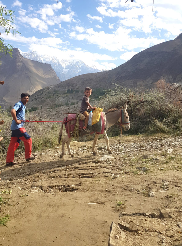 The first leg begins from Minapin Village, which is the starting point of the hiking route. Minapin Village is a quaint population within the Nagar Valley, and the locals there are mostly farmers who work the lands up to the mountains. My friends and I met a nice guy from the village called Hussein, whom, while in the midst of applying for college, was bored to death and wanted to come with us on the hike. He claimed that he goes up there at least once a year for fun (what??) with his friends anyway. As soon as you get to the edge of the village near a hydroplant, the track instantly starts climbing in a zigzag pattern. We started very early in the morning, and it was normal to be climbing this part of the terrain with other locals with donkeys as a lot of them would be headed up to their hillside farms to work for the day. An old guy with normal shoes and a donkey surpassed me and disappeared in a matter of minutes without so much of looking even slightly breathless, so you can understand how that messed with my self-esteem a little. At this point your adrenaline wouldn’t have kicked in yet, so the climb will be a little painful. 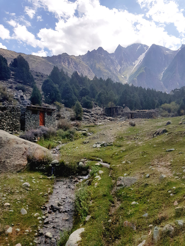 The second leg is a lot easier than the first one. The incline reduces, and you come to nice forested area with beautiful greens and small rivers. On my climbing day there was absolutely no other hiker on these tracks except for myself, two other friends, Hussein and another Australian climber. One of the best things about this climb is that due to its unpopularity, you get the place all to yourself. During this leg of the hike, you’ll come across a small village made of ragged stones and overlooking the mountain ranges. I loved the place – it reminded me of scenes from the Vikings TV Show for some reason. Eventually you’ll walk out of the forested area and into a new territory – vast green fields and a sharp incline of the tracks. You’ll also begin seeing glimpses of the Minapin Glacier. I was so excited to see it, but this is also how you know the second leg of the hike is ending and the next few hours is going to be a bitch (excuse my French). 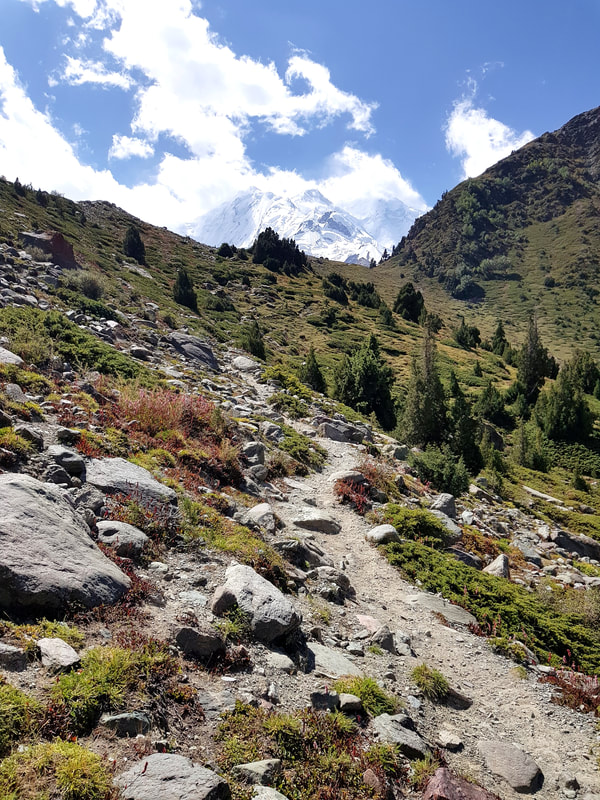 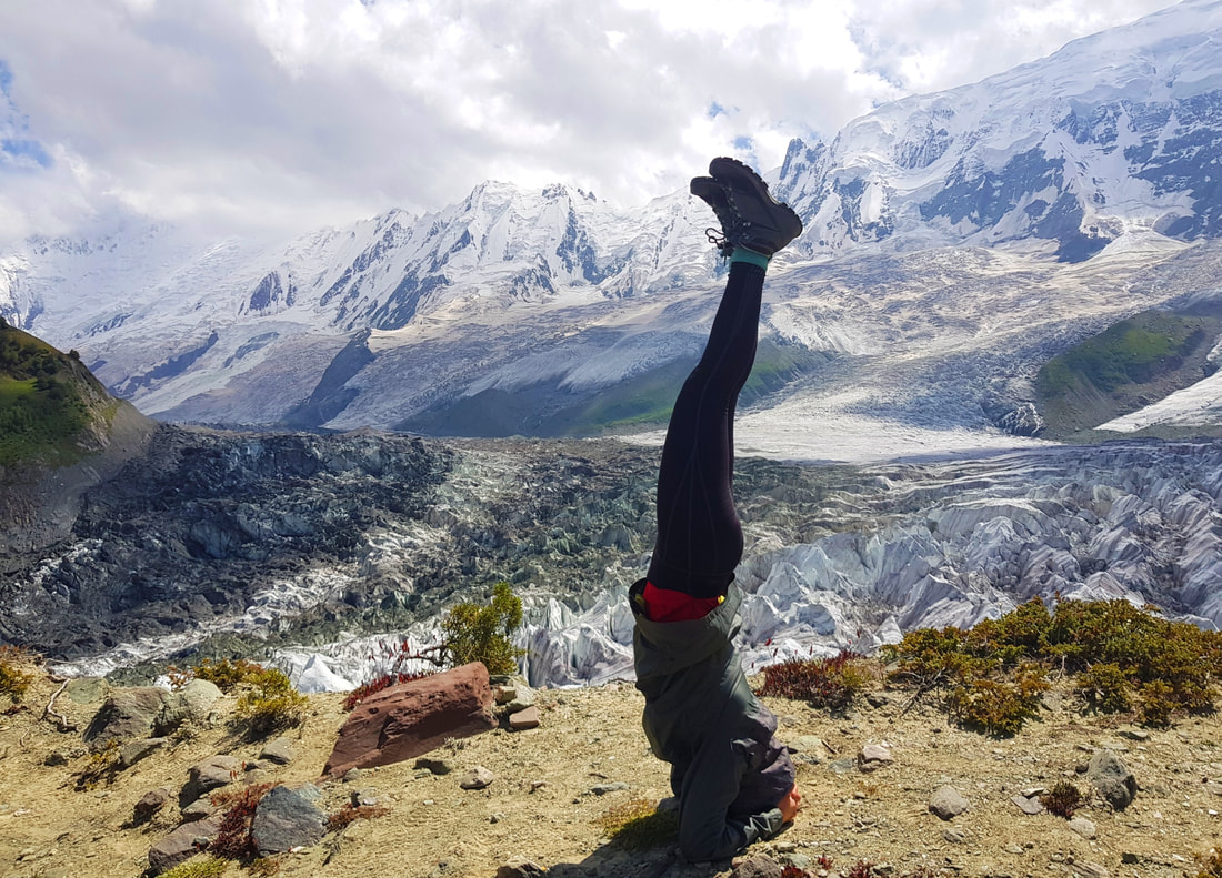 The third leg of the hike is the hardest for me. The ground was unconsolidated, which meant that I had to use more energy to climb, and it was easy to slip and fall on your butt (which I did, twice. The second one hurt). The area was also a lot more open, and the wind and sun made it more challenging. In the spirit of sharing, I must also state that I was on my period, and this caused me to feel tired and dehydrated fairly quickly – I found myself needing more breaks, and needing more snacks. The gradual climb will eventually let you come to a meadow with a beautiful trail and beautiful alpine flowers, and the peak of the Rakaposhi Mountain will be very visible. It was so beautiful I forgot all about my lethargy and raced up to the top. And once you’re at the top of that trail, hold your breath, people. You’re about to see one of the most beautiful sights you would ever lay eyes on – miles and miles of white-as-sheet glacier set at the bottom of an enormous snowy mountain range, the glaciers peeking out as though they were frozen large ice waves. And absolutely no White Walker in sight. Like I’ve said before, one of the best treats of this Base Camp is that it is absolutely void with people, so you get a stunning scenery with zero Insta-star posing for 500 shots at the viewpoints for, you know, ‘content’. 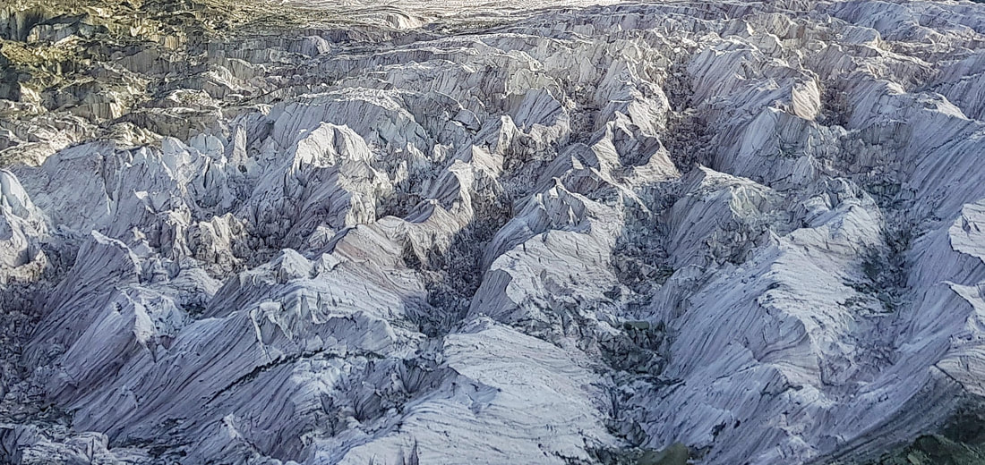 Now you can choose to stop here. You can. In fact, most people would. But what you can also do is continue to the fourth leg of the hike – the trail past the Base Camp, and onto the glacier. Yes, you’ve seen the ice sheet, now why not be on it? Follow the trail which will take you to the Base Camp grounds (a secluded area with a camping site, a small building, a dodgy toilet and a small creek), and carry on beyond it towards the direction of the glacier. We had to climb up and down some large rubbles and it was quite exhausting especially after an entire day hiking, but once I got on top of the glacier it felt worth it. Cold ice water streams also meant you can refill your drinking bottles, and while doing so I pictured myself in an Evian ad. If you plan to go back down on the same day, you should begin at the latest around 3pm. This would allow you to reduce the time hiking in the dark, especially through the third leg of the hike where the descend is steep and the grounds are lose, which would be dangerous. You don’t want to be the annoying tourist that caused the entire Minapin village to have to go out and rescue you (and this has happened before, according to locals). 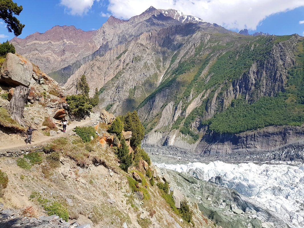 Based on my personal experience these would be my main tips (applicable only if you’re an average amateur hiker);
  I dozed off immediately after I got into the car that was supposed to take me from Islamabad to Hunza Valley. I think it was the lunch that got me so drowsy – yet another helping of Biryani, a mound of rice with secret pieces of chicken hidden within it, that made me feel instantly doozy. I think I slept for a good hour, but given that the entire ride will take a whole day, it didn’t matter so much. When I woke up, Islamabad had disappeared. What was before my eyes was now glimpses of the Pakistan highlands – vast, mountainous, majestic. This was the view I had from the car for the next 22 hours. 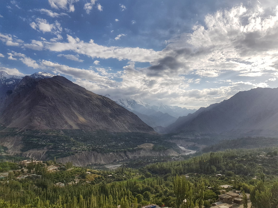 Hunza Valley's view from Baltit Fort, a must-visit if you want to more about the valley's history and take in the amazing views from an elevation 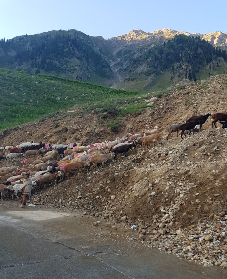 Local shepherds with their herds - some are young kids who looked like they're pros already That side of the world has always felt very intriguing for me. You know, ‘that side’. Not quite middle-eastern, at the foot of the most prominent mountain ranges on earth, and despite the bad-rep they always get from the media, remains mysterious and not quite well-known. Wasn’t it infamous for a Taliban-related attack not so long ago? Some Western news mass-generalized it as the place where women are oppressed – I never easily believe anything, so part of me wanted to go because I wanted to see this place for myself and feed my own curiosity. 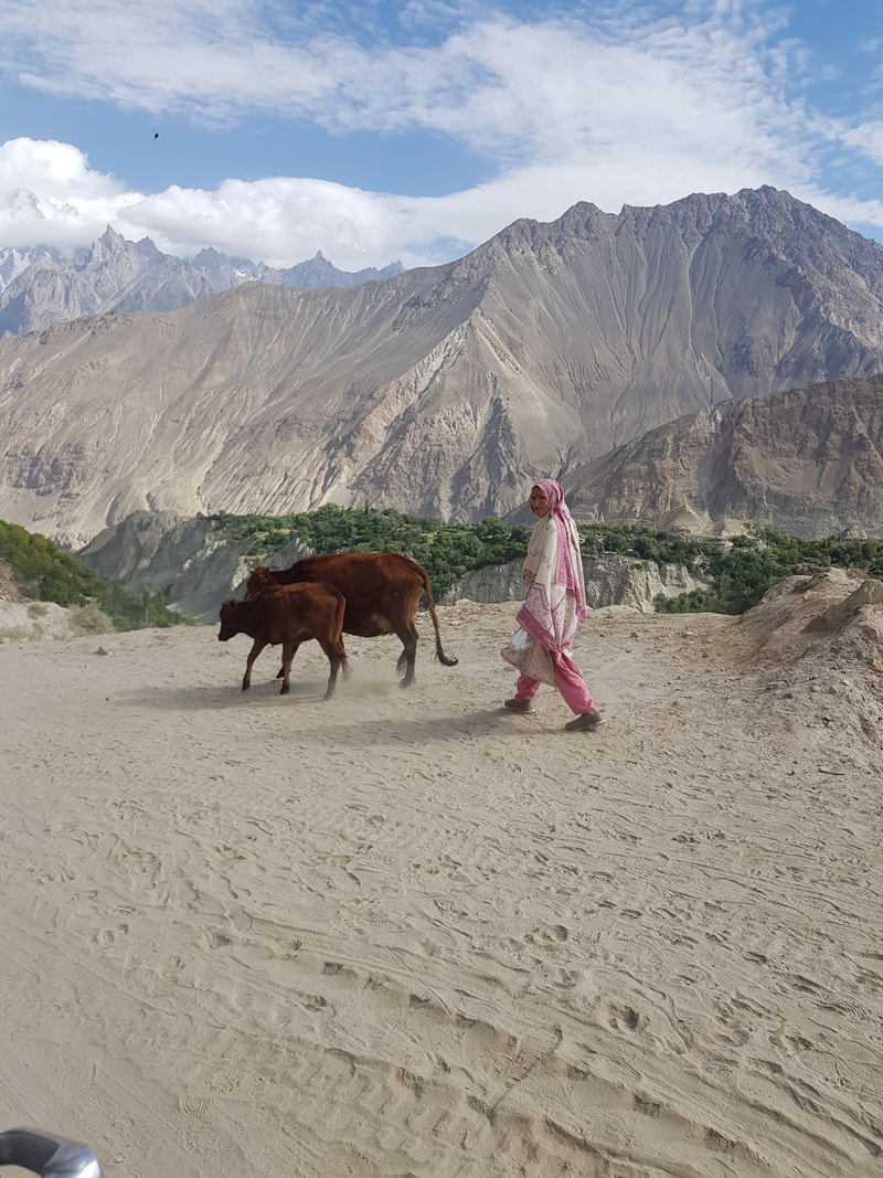 Hunza Valley is located in Northern Pakistan. On Google Map it looks like a tiny dot of a place sandwiched between thousands of miles of snowy mountain ranges. To get there, I had to first get myself to Islamabad. From Islamabad, I had a few options – take the 1 hour flight to Gilgit, and then a taxi from Gilgit to Hunza Valley, take the public bus (a popular one is faisalmovers.com) to Gilgit, and cab my way to Hunza Valley as well, or rent a car with a driver, who will drive me right to the doorsteps of the hotel. I took the last option, and shared the fare with three other guys. After all, nothing says nuts like sharing a car with a non-English speaking driver and another stranger for a drive that takes a long time. Prepare copies of your passport because there will be a lot of military check points along the way. You’ll also be required to put up a night somewhere because the check point gates are closed after 5pm. For more info on traveling by road to North Pakistan, see here. 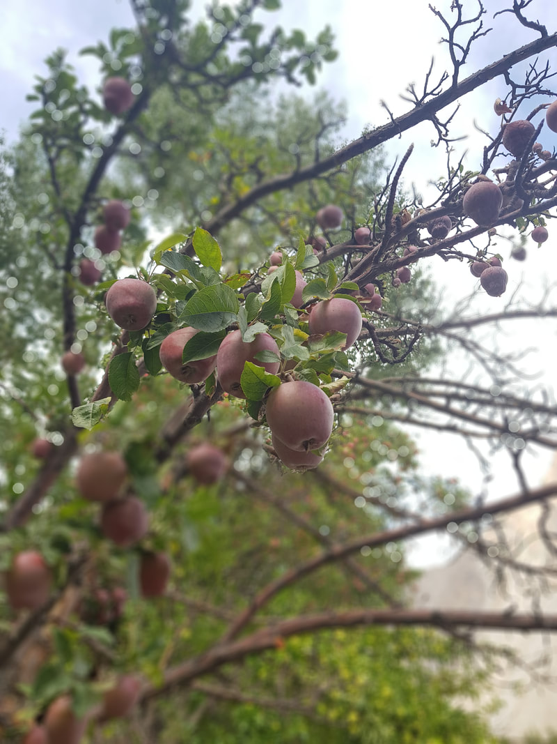 The end of summer is the season for apples, apricots and pears 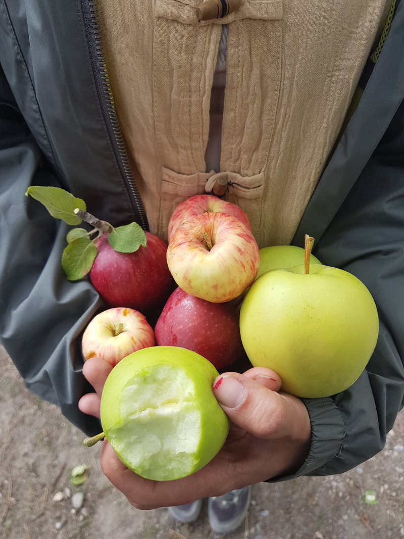 Locals would offer you fruits from their farms for free 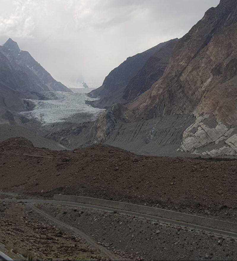 Passu Glacier Gilgit is one of the main towns in the North and everything else pretty much branches out from there. I stayed at Karimabad, which was a smaller town about 1 hour drive from Gilgit, at the heart of Hunza Valley. And let me just say this first and foremost – Hunza Valley is perhaps one of the most beautiful places I have ever been in my life, if not the most. No, I’m not overselling it. Tiny villages dot the area, surrounded by tall snow-capped mountain ranges everywhere you look. It feels like a place so isolated with its beauty remaining a huge secret. The people are so chill and friendly, no one wants to scam you and everyone wants to help you. The average lifespan here is around 95 years, and you can easily see why by looking at the lifestyle here. The land is so fertile and there are apple trees, apricot trees, peaches, pears, walnuts in everybody’s lawns, and you’re welcomed to help yourselves to as much as you want. I had my first taste of yak meat, which tasted strong and meaty, in local dishes comprising a lot of fat and meat, a common choice in this cold region. To best engross yourself in the area, take a nice long walk in the villages and watch people go about their daily routines, try local snacks, eat some fruits under the trees, and watch the sun set behind the mountains. 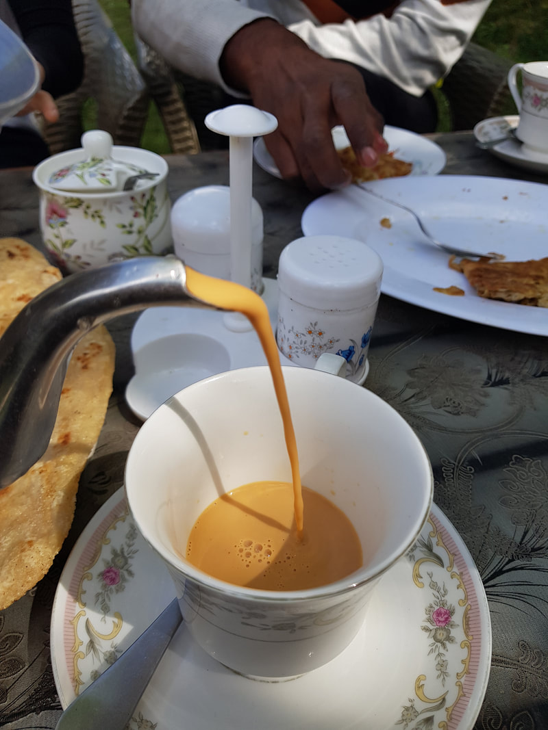 If you're not having at least one cup of chai per day, dammit you're not doing it right! 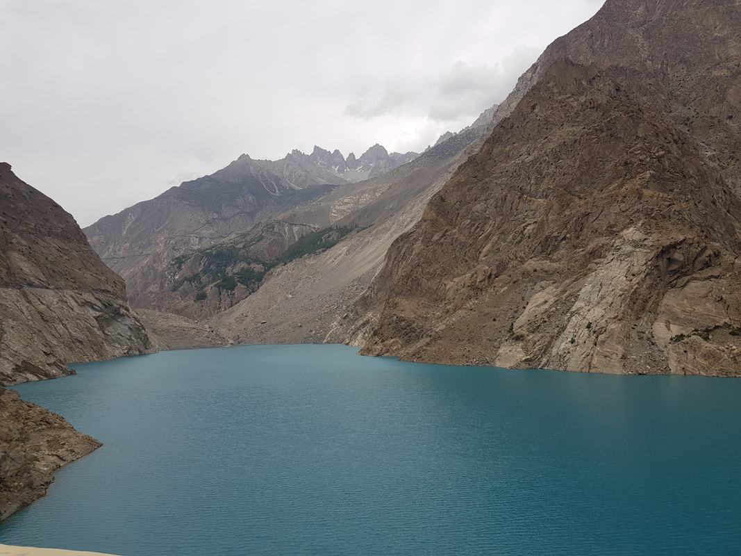 Attabad Lake with its blue waters, sourced directly by the glaciers 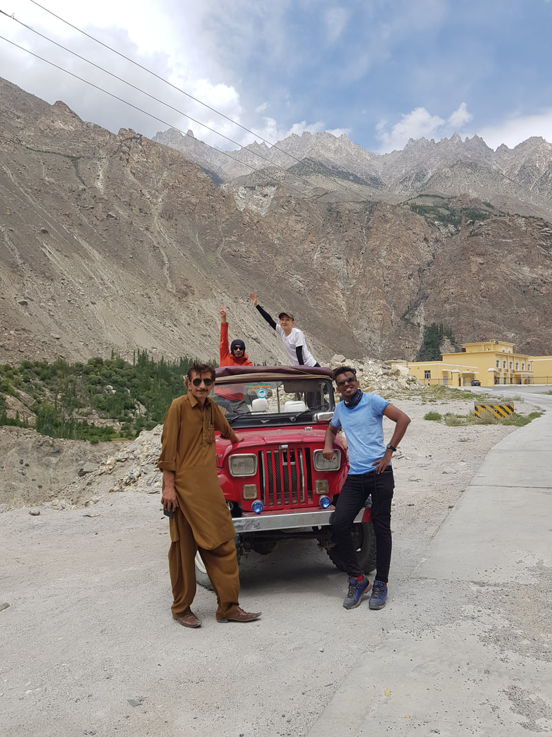 Mr Sultan, our jeep driver, with the jeep that took us places To get the most out of Hunza Valley and its surroundings, you need to get a jeep with a driver. For the entire day you can get a rate of about USD40, and explore some sights at your own leisure. Horpar Valley is a place not to be missed, a small village reachable through an insane narrow road right next to gut-wrenching cliffs. There is a viewpoint in the village where you can get unspoiled views of the Horpar Glacier. It’s the fastest moving glacier in the world, at 5cm/day. Attabad Lake is also worth a visit, an eerie beautiful blue lake fed by the glacier water that resulted from a massive avalanche that drowned a highway and a village, killing 11 people. Passu is a great little area where you can soak your sights on the amazing Cathedral or Cone Mountain – a ragged mountain range that looks like a giant crown, and driving in and between these places is an experience by itself. Standing on the seats of my jeep and just feeling the rush of the wind through me with the sunshine in my face and looking across to the vast, euphoric scenery made me feel like I was in a scene of a movie about a girl who was on a quest for the adventure of a lifetime. It was liberating and joyous, a feeling that is hard to explain. 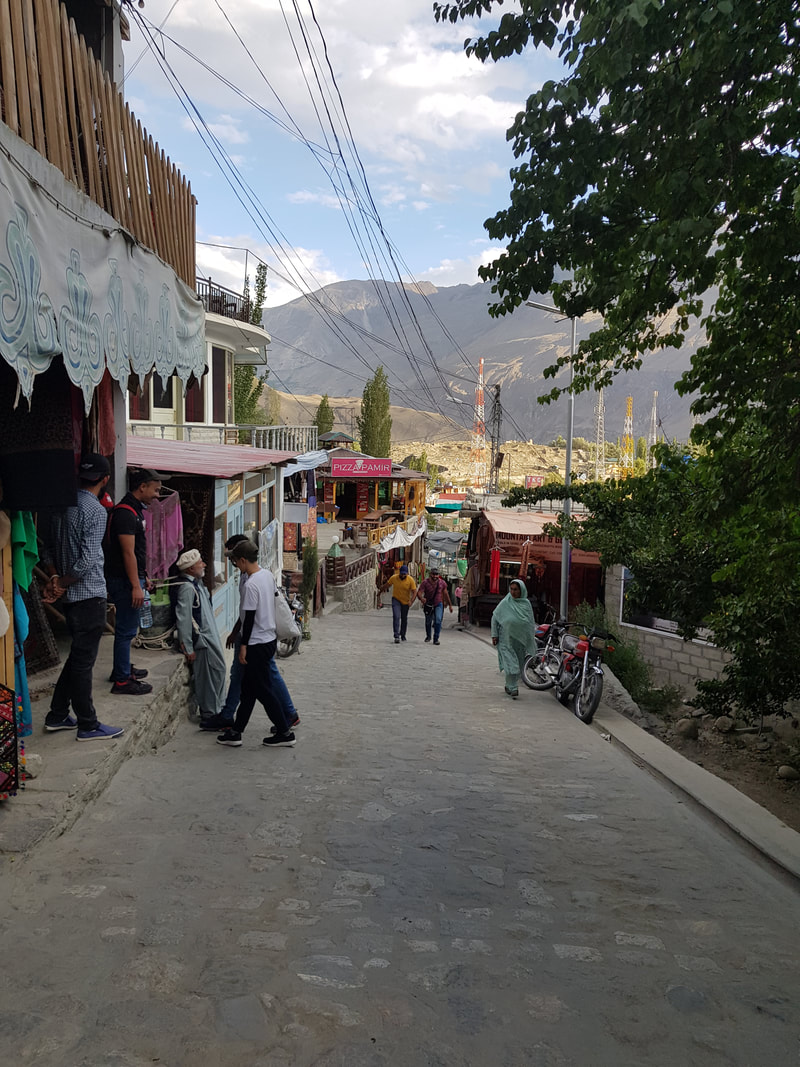 Walk around the villages, but wear proper shoes though. The pavements are mostly inclined. 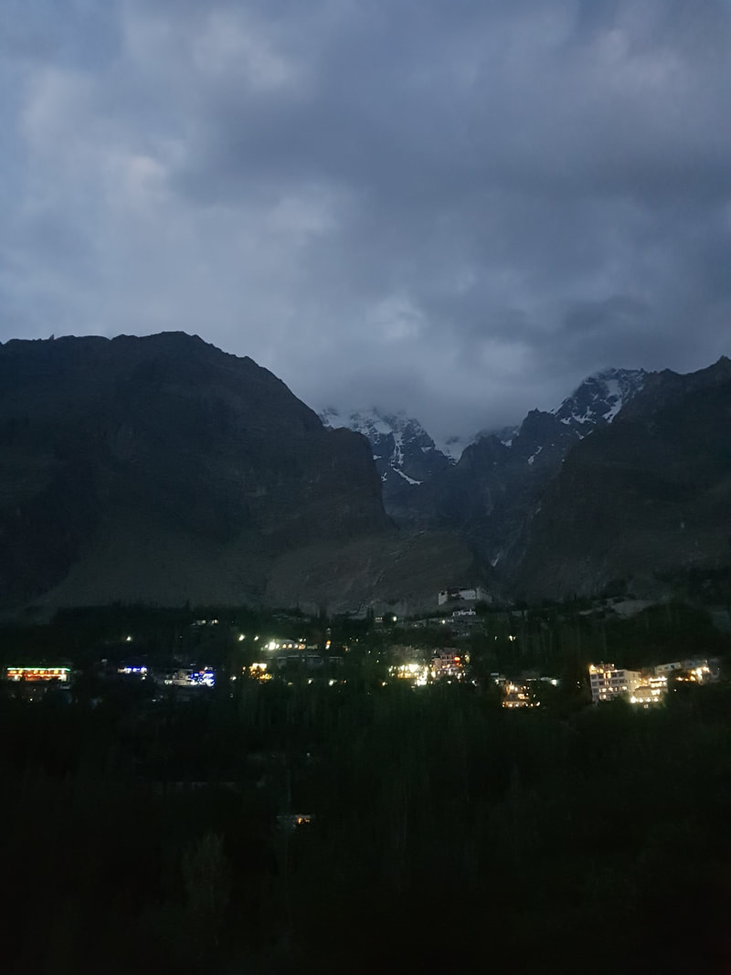 Hunza Valley at night If you’re looking for something more physical, like I always do when I’m traveling (I hate the whole sit-in-a-car-and-get-down-only-to-take-pictures motion), then boy do I have recommendations for you. I went hiking to the Rakopashi Base Camp, details of which you can read HERE. It’s not for the faint hearted but I promise you it is absolutely worth it. I also went to Fairy Meadows, arguably one the more famous trails in North Pakistan (also infamous: in 2010 11 people were shot here by the Taliban). It takes 2 hours of Jeep Ride through the second most dangerous road in the world (yep) and an additional 2-hour horse ride or 3-hour hike to get there. But once you do, it’s just extremely breathtaking. The entire meadow oversees Nagar Parbat, one of the highest mountains in the world. Need I say more? 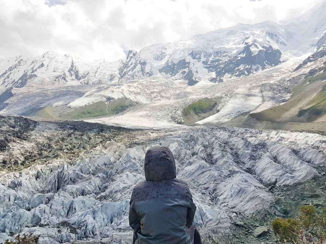 Rakaposhi Base Camp 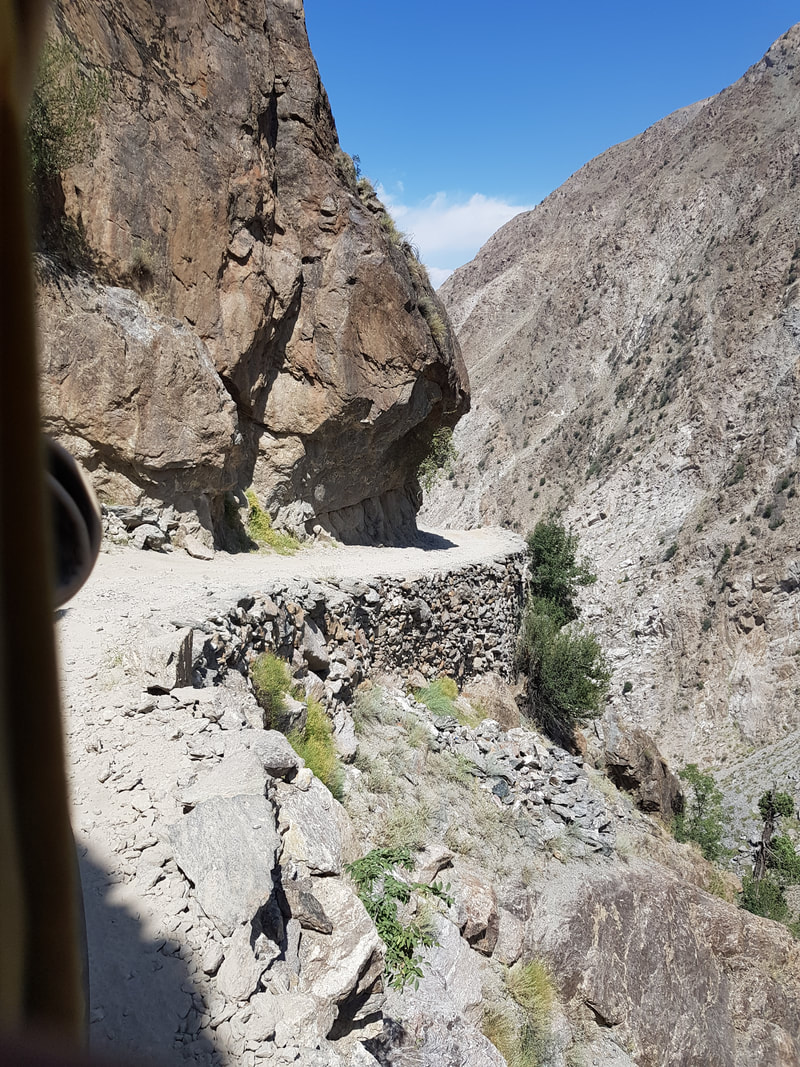 The Jeep road up to Fairy Meadows is the second most dangerous road in the world, and rightfully so. 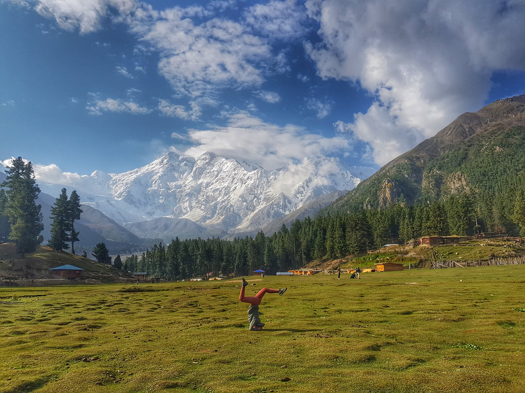 One with Nagar Prabat mountain, shot in Fairy Meadows. Nagar Prabat is one of the highest mountains in the world. 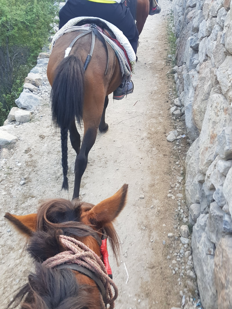 Horseback riding for about 2 hours to reach Fairy Meadows If you ask me, I’ll tell you this; North Pakistan is extremely underrated. A local told me that once, the place was a bustling tourist area, but after 9/11 the whole industry collapsed and with it, the economy of the locals. These days North Pakistan is largely safe. You’ll see many military check points and a lot of police and soldiers around, but it’s just a safety measure to ensure that what happened many years ago will not occur again. If you manage to brave the roads, the unpredictable public transport and the occasional “sorry there’s no electricity or hot shower because the generator went off throughout the entire village”, then I can almost guarantee you that Pakistan will be the voyage to remember. Definitely one for the books. 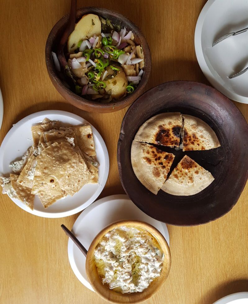 A sample of the Northern cuisine, top and clockwise - a variation of the potato salad with coriander, chilis and onions, local bread stuffed with yak meat, yak meat cooked in yoghurt, spices, coriander and soaked bread, and local cheese sandwiched between local bread. 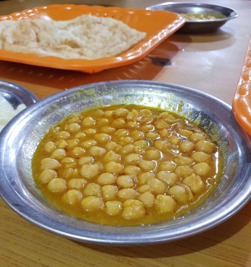 Often you'll see dishes like this chickpea curry. Locals have a knack of using simple ingredients like lentils, beans and veg and turning them into delicious simple curries to be dipped with warm local bread. 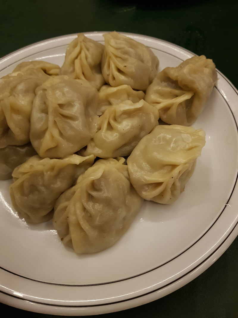 Dumplings stuffed with minced meat. As you get closer to the Chinese border you begin to see influences in the local dishes. What To Eat: the Pakistani palette is a must-try! I had one of the best chicken dishes I’ve ever eaten here, called Chicken Karahi – chicken pieces cooked in spices and yoghurt until the meat falls off the bone and you mop up all the sauce with some homemade bread. Yak meat is also worth a try in the Northern regions, commonly prepared with a lot of cheese and bread. There are also endless possibilities when it comes to beans, lentils and veggies, mostly cooked in a version of local curry. These are absolutely amazing with hot, fresh parathas. And please, please, please do not forget to indulge yourself with a tall glass of freshly blended apricot juice. They literally go out to the lawn and pick out the fruits from a tree and chuck them into a blender - it doesn't get any fresher than that. 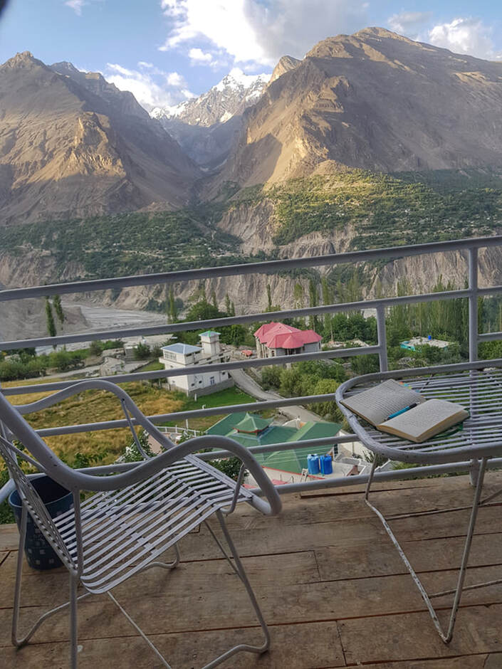 |
